Harmony Ridge Cemetery
A Texas Historic Cemetery
Cemetery Quick Links
Adams on CR 410
Adams on CR 262
Algerita
Baker Family
Bend
Big Uncle
Bowser Bend
Brister Ranch Grave
Brown, Shorty
Butcher
Catclaw (Weems)
Cedar Brake Cemetery
Chappel Cemetery
Cherokee (Hanna)
China Creek
Colony
Crawford
Clark, W. N. Family
Davidson
Deer Creek
Ellis (Rock Shoals)
Estep Family
Farr
Feazle Rock
Harkeyville
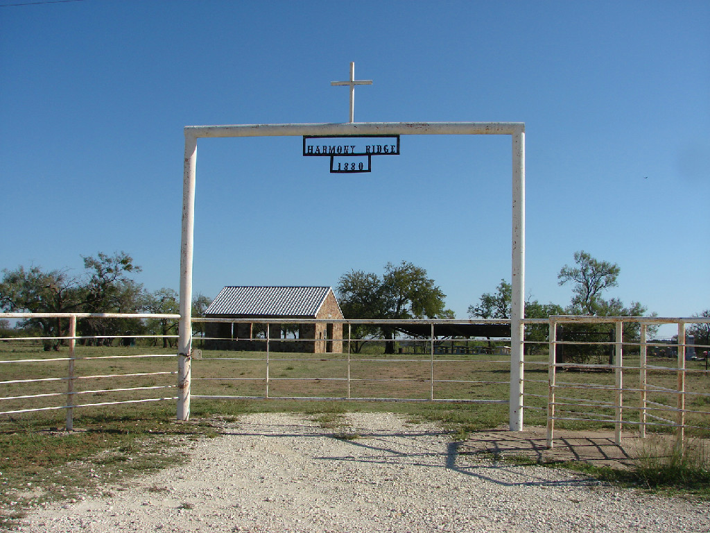
Harmony Ridge
Harris
High Valley
Hillcrest
Hinton
Holt
Jones
Kelley Family
King Family
Kuykendall
Latham
Linn
Locker
Mahan
Maxwell
May
McCarty
McConnell grave
McMillin
McPherson
Merrill Graves
Mesquite
Montgomery
Neel
Richland Springs (not available)
San Saba City
Shaw Bend
Sides
Sloan (Henderson)
Smelzer (Rough Creek)
Smith, John Wesley Family
Spring Creek
Sutton
Terry
Union Band
Varga Chappel
Union Band
Wallace Creek
The Harmony Ridge Cemetery is location in Eastern San Saba County in the Harmony Ridge Community. It is about 10 miles east of the city of San Saba on county road 126 near the confluence of the San Saba and Colorado Rivers.
GPS: Latitude: 31.2423o N Longitude: 98.5806o W
DIRECTIONS:
From the San Saba city limits on U.S. Highway 190, go east 6.7 miles to County Road 132.
Turn left onto CR 132 (unpaved) Go 1.9 miles to the junction with CR 126.
Stay right and follow CR 126 east 0.7 of a mile to Harmony Ridge Cemetery on the right.
CONDITION:
This old cemetery, established in 1878, is still in use as a burial ground in 2014. It is located on land donated by the Oliver brothers, Andrew, Mark and Polk.
The cemetery is an area of about 1.5 acres enclosed by a 4 ft. high wire fence with metal post. The main entrance, a twelve ft. wide gate, in near mid-point in the east fence line. The cemetery has been and continues to be well-maintained by an active cemetery association.
More information on the Harmony Ridge Community can be found in San Saba County History 1856-1983, Vol. 1 pp 452-453