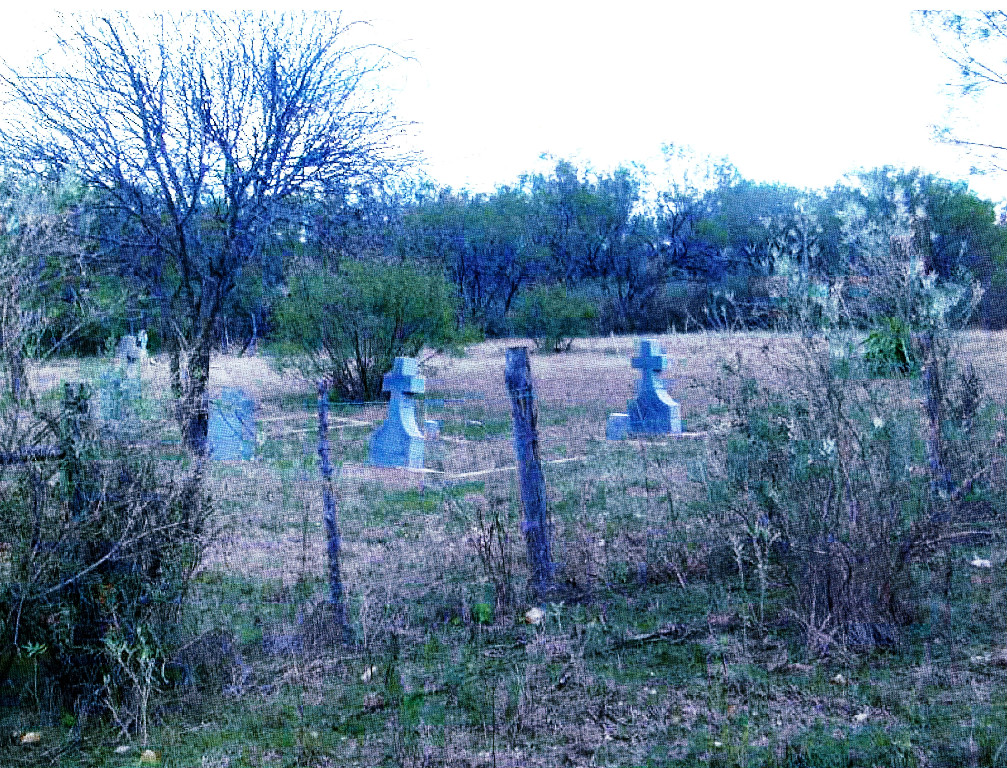
Harkeyville Cemetery
Cemetery Quick Links
Adams on CR 410
Adams on CR 262
Algerita
Baker Family
Bend
Big Uncle
Bowser Bend
Brister Ranch Grave
Brown, Shorty
Butcher
Catclaw (Weems)
Cedar Brake Cemetery
Chappel Cemetery
Cherokee (Hanna)
China Creek
Colony
Crawford
Clark, W. N. Family
Davidson
Deer Creek
Ellis (Rock Shoals)
Estep Family
Farr
Feazle Rock
Harkeyville
Harmony Ridge
Harris
High Valley
Hillcrest
Hinton
Holt
Jones
Kelley Family
King Family
Kuykendall
Latham
Linn
Locker
Mahan
Maxwell
May
McCarty
McConnell grave
McMillin
McPherson
Merrill Graves
Mesquite
Montgomery
Neel
Richland Springs (not available)
San Saba City
Shaw Bend
Sides
Sloan (Henderson)
Smelzer (Rough Creek)
Smith, John Wesley Family
Spring Creek
Sutton
Terry
Union Band
Varga Chappel
Union Band
Wallace Creek
Location:
In west central San Saba County near the community of Harkeyville on property owned by Billy R. Davidson.
GPS: Latitude:31.1953oN Longitude: 98.8015oW
 Directions:
• From San Saba city limit (west) on U. S. Highway 190 go west 2.3 miles to FM 2732. (The Sloan Road)
• Turn left onto FM 2732 and go 0.9 mi to CR 306.
• Turn left onto CR 306. Go slowly .3 mile to cattle guard and gate on the left.
• Cross cattle guard and turn left through double gate that opens into a pasture. (The gate is of heavy metal pipe and is painted red. It is not locked.)
• Stay left on pasture road. Go about 50 yards to cemetery.
Condition:
This cemetery is located in typical hill country pastureland, covered by mesquite, mountain cedar, catclaw, bee brush, prickly pear and other cacti, tall prairie grass and needle grass. It covers about .5 of an acre and is fenced by a four ft. high wire fence. There is an entrance gate at the southwest corner of the west fence line. About one third of the cemetery along the south fence line west to east is well maintained. However, the remainder shows evidence of complete neglect. Mesquite and other thorn-brush need to be removed and the entire area is consumed by tall grass that makes locating gravesites very difficult.