Kuykendall Cemetery
Cemetery Quick Links
Adams on CR 410
Adams on CR 262
Algerita
Baker Family
Bend
Big Uncle
Bowser Bend
Brister Ranch Grave
Brown, Shorty
Butcher
Catclaw (Weems)
Cedar Brake Cemetery
Chappel Cemetery
Cherokee (Hanna)
China Creek
Colony
Crawford
Clark, W. N. Family
Davidson
Deer Creek
Ellis (Rock Shoals)
Estep Family
Farr
Feazle Rock
Harkeyville
Harmony Ridge
Harris
High Valley
Hillcrest
Hinton
Holt
Jones
Kelley Family
King Family
Kuykendall
Latham
Linn
Locker
Mahan
Maxwell
May
McCarty
McConnell grave
McMillin
McPherson
Merrill Graves
Mesquite
Montgomery
Neel
Richland Springs (not available)
San Saba City
Shaw Bend
Sides
Sloan (Henderson)
Smelzer (Rough Creek)
Smith, John Wesley Family
Spring Creek
Sutton
Terry
Union Band
Varga Chappel
Union Band
Wallace Creek
LOCATION:
This old cemetery is located in southwest San Saba County 1.4 mile west of the town of Cherokee. It is on the top of a hill along the north side of FM 501.
DIRECTIONS: 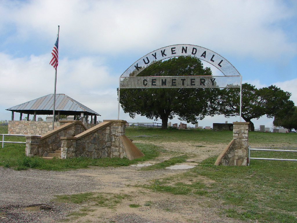
- From the town of Cherokee
- Turn off of state highway 16 onto FM 501
- Go west 1.4 mile to Kuykendall Cemetery sign
- Turn right and go uphill into the parking lot for the cemetery. The cemetery is visible from FM 501.
GPS: Latitude: 30˚ 58.952 Latitude: 98˚ 44.058
CONDITION:
This plot of land situated on top of a hill overlooking a wide open valley was set aside in the early 1880’s to be used as a community burial ground by the families who were the first to settle along the upper Cherokee Creek. Land for the original plot was given by W. J. and Elizabeth Jane Kuykendall and neighbor George J. Gray. Each family gave one-half acre. At a later date Raymond Gray, son of George J., gave an additional acre to add to the original plot and some time later he sold another small amount of land to the Cemetery Association.
The Cemetery is enclosed by an attractive welded-pipe fence on the south end and east side with a large main entrance gate in the east fence line (See Photo Log). The north end and west side fences are of barbed and net wire. A 20 ft. by 24 ft. pavilion is located in the southeast part of the cemetery near the main entrance.
This cemetery has been and continues to be well maintained. The cemetery is supported by gifts to an endowment fund. Interest is used for upkeep
Submitted by: Stan Burnham March, 2011. Updated August 2015